
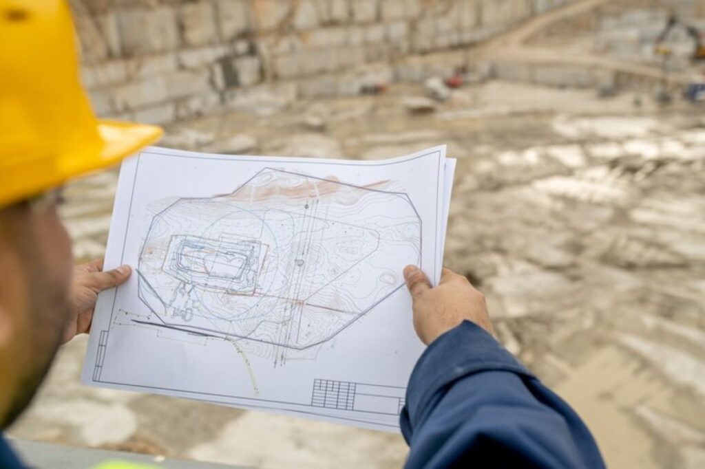
Understanding Cadastral Surveying and Its Role in Land Subdivision Projects
Cadastral surveying is a specialised field of land surveying that focuses on establishing and documenting property boundaries for legal and administrative purposes. This critical surveying discipline creates detailed records of property dimensions, locations, and ownership rights, forming the foundation for land subdivision projects.
The significance of cadastral surveying in land subdivision becomes evident through its essential functions:
- Legal Documentation: Creates legally binding records of property boundaries and ownership
- Spatial Accuracy: Determines precise measurements and locations of land parcels
- Infrastructure Planning: Enables effective planning for utilities and services
- Risk Mitigation: Identifies potential issues before development begins
Cadastral surveying aids land development through multiple key processes:
- Initial Assessment
- Site evaluation
- Existing boundary verification
- Topographical analysis
- Development Planning
- Lot configuration
- Access point identification
- Utility corridor planning
- Legal Compliance
- Local council requirements
- State regulations
- Environmental considerations
Professional cadastral surveyors utilise advanced technology and expertise to ensure accurate, reliable results for land subdivision projects. Their work creates a solid foundation for successful property development, helping prevent future disputes and ensuring compliance with regulatory requirements.
Establishing Precise Property Boundaries for Successful Land Development
Establishing precise property boundaries is crucial for successful land development. Cadastral surveying techniques provide an accurate method for defining property lines, ensuring legal compliance and protecting property rights.
Key Functions in Boundary Definition:
- Identifying existing monuments and markers
- Measuring distances and angles between boundary points
- Documenting physical features affecting property lines
- Recording elevation changes and topographical details
- Verifying historical survey records and documentation
The implementation of cadastral surveying for multiple lot subdivisions requires meticulous attention to detail. Professional surveyors utilise advanced measurement tools to map out proposed lot boundaries while considering:
- Minimum lot size requirements
- Street frontage specifications
- Access requirements
- Setback regulations
- Utility easements
Creating accurate subdivision plans involves integrating existing boundaries with new property lines. This process includes:
- Initial Site AnalysisAssessment of current property boundaries
- Identification of existing easements
- Review of zoning requirements
- Boundary DefinitionPlacement of new lot lines
- Calculation of lot dimensions
- Establishment of corner markers
- DocumentationCreation of detailed survey plans
- Recording of boundary coordinates
- Preparation of legal descriptions
The precision of cadastral surveys directly impacts the success of land development projects. Modern surveying equipment, including robotic total stations and GPS technology, enables surveyors to achieve millimetre-level accuracy in boundary definitions. These high-tech tools are often part of comprehensive land surveying services.
Professional surveyors must also consider natural features and existing infrastructure when establishing new boundaries. This includes:
- Watercourses and drainage patterns
- Significant trees and vegetation
- Underground utilities
- Road alignments
- Building locations
These elements influence the placement of new lot boundaries and affect the ultimate development potential of subdivided land parcels.
Ensuring Compliance and Standards through Cadastral Surveying
Cadastral surveying plays a vital role in maintaining regulatory compliance throughout land subdivision projects. Local authorities and state governments enforce strict guidelines for land development, making professional cadastral surveys essential for project approval.
Key Regulatory Requirements:
- Adherence to zoning regulations
- Compliance with minimum lot sizes
- Setback requirements
- Access and easement provisions
- Environmental protection measures
Cadastral surveyors conduct thorough investigations to identify existing easements, encumbrances, and restrictions that affect land use. This detailed assessment helps prevent potential legal issues and ensures development plans align with local authority standards.
Boundary Dispute Prevention
Professional cadastral surveys create legally defensible documentation of property boundaries through:
- Identification of original survey marks
- Recovery of missing boundary markers
- Establishment of new reference points
- Detailed documentation of physical features
- Creation of accurate survey plans
These comprehensive records serve as crucial evidence in resolving boundary disputes and protecting property rights. The precise measurements and documentation provided by cadastral surveys establish clear legal boundaries, reducing the risk of future conflicts between neighbouring properties.
Easement Management
Cadasral surveying identifies and documents various types of easements:
- Utility easements for power, water, and telecommunications
- Right-of-way access
- Drainage easements
- Conservation easements
This detailed information enables developers to:
- Plan infrastructure placement effectively
- Protect existing utility corridors
- Design appropriate access routes
- Maintain required setbacks from easements
The accuracy and legal validity of cadastral surveys provide essential protection for property owners, developers, and local authorities. These surveys create a reliable foundation for land development projects while ensuring compliance with all relevant regulations and standards. You may like to visit https://synctocloud.net/the-importance-of-construction-survey-in-site-development/ to get the importance of construction survey in site development.
Leveraging Advanced Technologies for Accurate Cadastral Surveying Results
Modern cadastral surveying has undergone a technological revolution with the integration of advanced tools and techniques. Laser scanning technology stands at the forefront of this evolution, providing unprecedented accuracy and efficiency in land subdivision projects.
Laser Scanning Technology Applications
High-Precision Data Collection
- Captures millions of data points per second
- Creates detailed 3D representations of terrain
- Measures complex structures with sub-millimetre accuracy
- Records hard-to-reach areas safely and efficiently
Real-Time Processing Capabilities
- Generates instant point cloud data
- Allows immediate verification of survey completeness
- Reduces time spent on site revisits
- Enables rapid data analysis and processing
Spatial Information Integration
The integration of spatial information through advanced technologies transforms the decision-making process during land subdivision projects:
Digital Terrain Modelling
- Creates accurate topographic representations
- Identifies drainage patterns and natural features
- Assists in optimal lot placement and orientation
- Supports earthwork calculations and planning
GIS Integration
- Combines multiple data layers for comprehensive analysis
- Maps utilities and infrastructure locations
- Identifies potential development constraints
- Facilitates strategic planning decisions
Advanced technologies enable surveyors to deliver precise, comprehensive data sets that support informed decision-making throughout the subdivision process. These tools enhance the ability to identify potential challenges early in the project lifecycle, reducing costs and minimising delays.
The combination of laser scanning and spatial information technologies creates a robust foundation for successful land subdivision projects. These technological advancements support accurate boundary determinations, efficient project planning, and effective communication between stakeholders.
Managing Complex Land Tenure Issues Effectively with Cadastral Surveying Expertise
Land tenure complexities present significant challenges in subdivision projects. Professional cadastral surveyors play a vital role in navigating these intricate issues through their expertise and precise methodologies.
Key Areas of Land Tenure Management:
- Historical Title Research
- Indigenous Land Rights Assessment
- Easement Identification
- Boundary Dispute Resolution
- Multiple Ownership Considerations
Cadastral surveying professionals conduct thorough investigations of existing land records, historical documents, and previous survey data to establish clear ownership boundaries. This comprehensive approach helps identify potential conflicts before they escalate into costly legal disputes.
The accuracy of cadastral surveys proves instrumental in risk minimisation during land development projects. Precise data collection and analysis enable developers to:
- Identify encroachments and unauthorised structures
- Verify compliance with zoning regulations
- Document existing rights-of-way
- Map utility corridors and service easements
- Validate property dimensions and areas
Professional cadastral surveyors utilise their expertise to address complex scenarios such as:
“Overlapping title claims, undefined boundaries, and historical discrepancies require meticulous attention to detail and expert interpretation of legal documentation.”
Risk management strategies implemented through cadastral surveying include:
- Detailed Documentation: Creating comprehensive records of boundary determinations
- Legal Compliance: Ensuring adherence to local and state regulations
- Stakeholder Communication: Facilitating clear dialogue between property owners
- Quality Assurance: Implementing rigorous checking procedures
- Data Verification: Cross-referencing multiple data sources
The integration of accurate cadastral data with modern land information systems enables efficient management of complex tenure arrangements. This systematic approach helps protect the interests of all stakeholders while supporting successful project outcomes.
Professional cadastral surveyors work closely with legal professionals, property developers, and local authorities to resolve tenure-related challenges. Their expertise proves essential in maintaining the integrity of land subdivision projects and ensuring long-term development success.

Conclusion
Cadastral surveying is essential for successful land subdivision projects. It involves precise measurements and expert knowledge to establish clear property boundaries and plan land use effectively.
By using advanced technologies, following regulations, and addressing complex land ownership issues, cadastral surveying provides the necessary framework for successful property development.
Professional cadastral surveyors, such as those at Wumara Group, offer valuable expertise to land subdivision projects in NSW and QLD. Their comprehensive understanding of property boundaries, compliance requirements, and risk management turns difficult subdivision projects into well-executed developments that satisfy both regulatory standards and client expectations.
The future of land development depends on the ongoing evolution and application of cadastral surveying principles. This will ensure sustainable, legally-compliant, and accurately-defined property subdivisions for future generations.